My heart rests in the hill.
I may not grudge, the little left undone.
I hold the heights, I keep the dreams I won.~Geoffrey Winthrop Young, I Hold the Heights
By our second morning in Dingboche, I was starting to suffer. Not in an unbearable sort of way, but rather a series of minor issues were compounding to the point that they could no longer be ignored. It had started with a random case of acid reflux all the way back in Tengboche. I’d disregarded it at the time, but it was getting worse by the day. Then there was the cold. The simple act of getting out of my sleeping bag in the morning had become a Herculean effort because of it. I had also developed a cough, along with a sore throat and nasal congestion. The strangest part of that was I couldn’t tell if I was actually sick, or if it was just a reaction to the cold mountain air. And as I handed over half of my breakfast to Vince yet again, I finally admitted to myself something that had been nagging at the back of my mind for the past two days. The altitude was responsible for my poor appetite. Whether or not I’d develop more symptoms of AMS (Acute Mountain Sickness) remained to be seen.
With all of these factors added together, it was high time for me to acknowledge that walking to Mount Everest is actually hard. But in a strange way, the suffering was exhilarating. After all, I hadn’t undertaken this journey under any illusions, or indeed hopes, that it would be easy. In fact, I would have felt slightly… well, slighted if I’d been able to skip up to Base Camp without having to overcome any hardship at all. And as our team set out from Dingboche that morning, I played the words “hard things are good for you” on a mental loop.
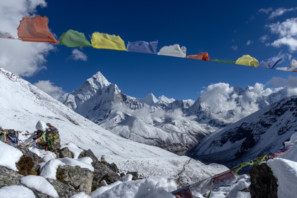
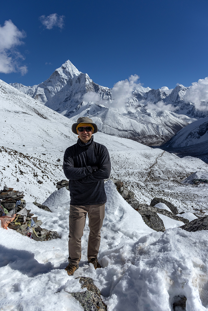
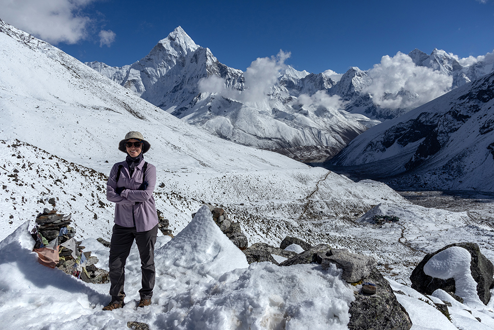
We’d gotten a later start than expected which resulted in a packed trail as we ascended a small portion of Nangkartshang, the peak we’d done an acclimatization circuit on the day before. The crowd was actually a welcome sight for me though, because it forced us to walk slowly, which was the only pace I was capable of anyway. The morning sun had already crept high above Ama Dablam, bathing the Imja Valley in its warmth. It was amazing to me just how hot it could get when the sun was out, after I’d just spent the night shivering despite being bundled up in layers of thermal gear. The sun was a welcome respite from the freezing darkness, but it wasn’t without it’s own challenges. Just the day before, I’d managed to get a bad burn on both of my hands, and now I made sure to cover up in a sun shirt, wide-brimmed hat, layers of sunscreen, and thin gloves although my hands were sweating in them.
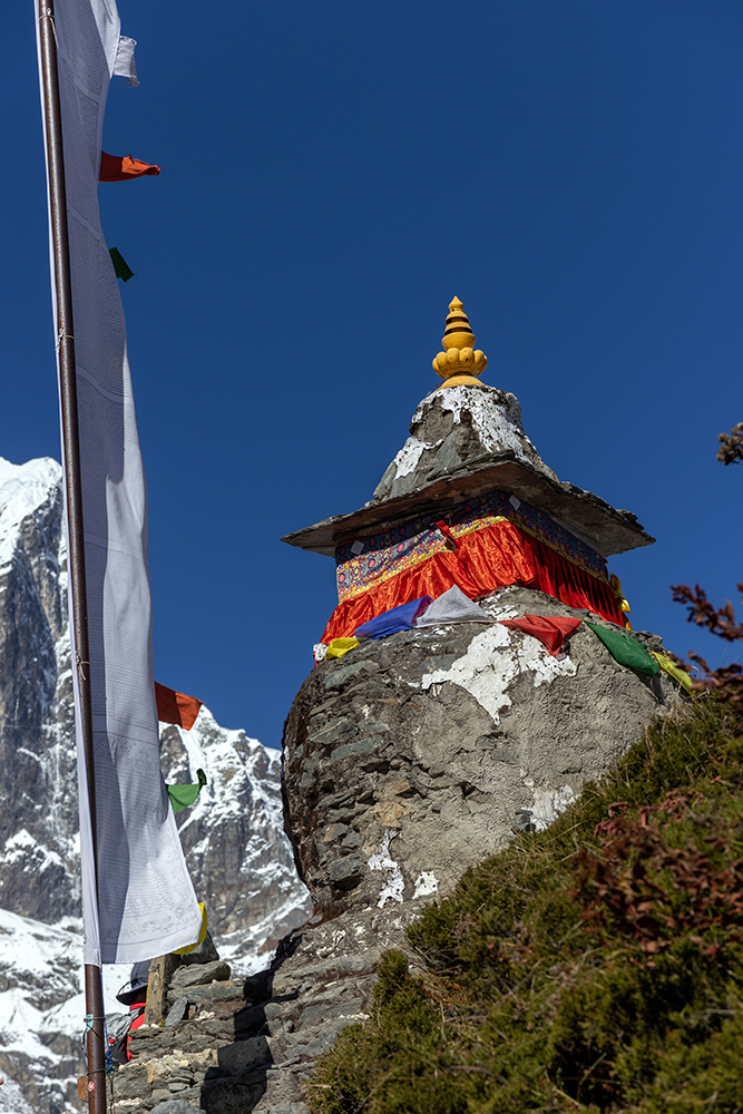
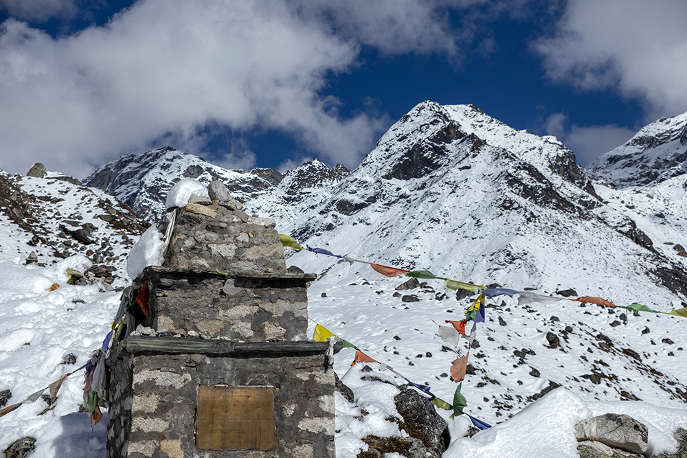
Before long, we crested over the base of Nangkartshang near a small Stupa whose white paint had almost entirely crumbled from its surface. From here, we could see the village of Pheriche, where we would be staying on our way back down from Base Camp in two more days. That is, if everything went to plan.
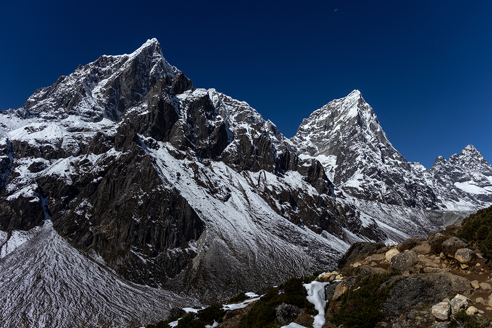
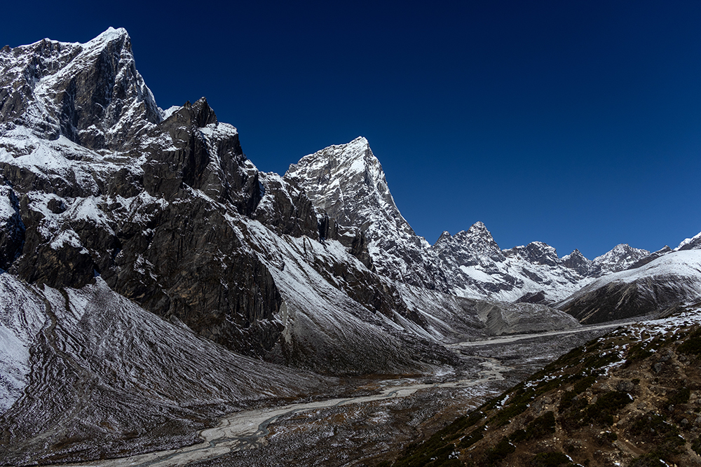
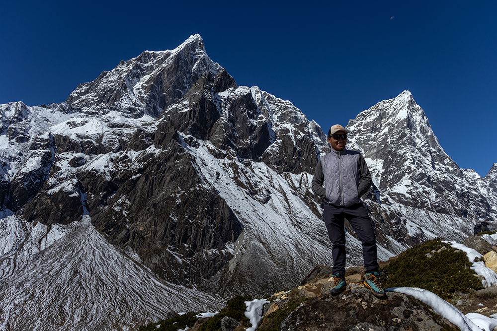
Taboche and Cholatse stood sentinel over the valley, their jagged slopes showing signs of snow melt since yesterday’s acclimatization hike. Blindingly white snow now stood in contrast with dark earth, and the trail had thawed into a thick, muddy slurry. We tromped slowly through the muck, water splashing up onto our pants legs and leaving behind a dusty residue as it dried. When we stopped to take a break, I added a pair of “North Fake” leg gaiters that I’d purchased in Dingboche to my ensemble. These would keep my pants dry and mud-free.
Even though the trail was relatively flat, walking still required an immense amount of effort thanks to the altitude. We inched our way slowly through the valley, stopping every so often to hydrate and admire the jaw-dropping scenery. The elevation gain through the valley was subtle, but I could still recognize it because as we walked, the muddy path became gradually snowier yet again.
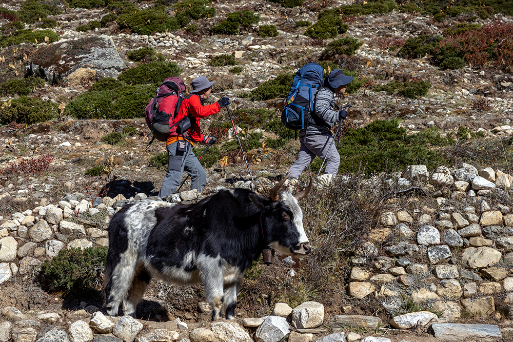
When we were about halfway to our lunch stop, we passed through an old yak farm whose fences and buildings were made entirely of stones from the surrounding landscape. The Pheriche Valley is known for its traditional yak farming, an industry that is vital to the way of life in the Khumbu region. Yaks are essential in carrying heavy loads up to the villages, and are also used for their meat and their milk. Animals are not allowed to be slaughtered within Sagarmatha National Park, but yaks still transport meat into the park for food (although trekkers are advised to avoid eating it).
There were no yaks in sight at the moment, but I appreciated how harmoniously the farm itself melded into the landscape that surrounded it.

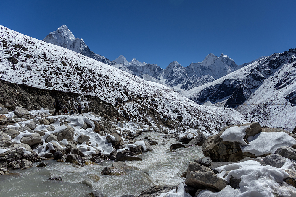
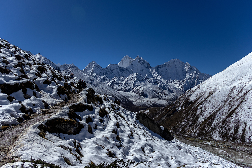
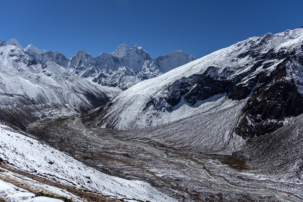
At lunch time, we reached the end of the valley where we crossed a bridge that spanned a very rocky section of the Tsola River. Looking back across the valley, I could see the now-distant peaks of Ama Dablam. The river’s water flowed over boulders and disappeared around a bend, while Ama Dablam was partially obscured by a much smaller hill. We’d spent the past few days getting ever closer to the picturesque mountain, and it seemed strange to be leaving it behind.
On the other side of the river, we stopped at the small outpost of Dughla to eat lunch. There were only a few buildings in the entire settlement, a couple of guesthouses, a bakery, and a restaurant whose courtyard was crowded with trekkers. We sloughed off our day packs, and found a table big enough for our team of nine. I was grateful for a cup of hot lemon ginger honey tea to sooth my raw throat, and I made an attempt at finishing my lunch, but gave up about halfway through my grilled nak (female yak) cheese sandwhich.
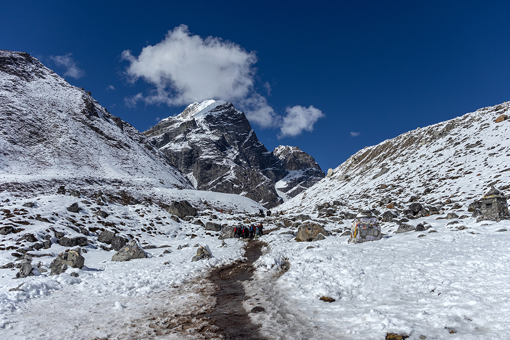
It seemed like it took longer than usual to eat lunch. Maybe it was because the restaurant was so busy, or maybe it just felt like it took longer because my own trepidation over what was coming up next made the time expand for me. I’d made the unfortunate decision of looking up in the direction we were headed, and what I’d seen was a daunting-looking hill that we would have to start climbing any minute now.
Eventually, everyone had finished eating, used the bathroom, and reapplied sunscreen. It was officially time to get back on the trail, and the hill began immediately as we left Dughla. When I look back on pictures and videos that I took of this hill, it doesn’t seem possible that this was the obstacle that nearly broke me. It just looks like a hill.
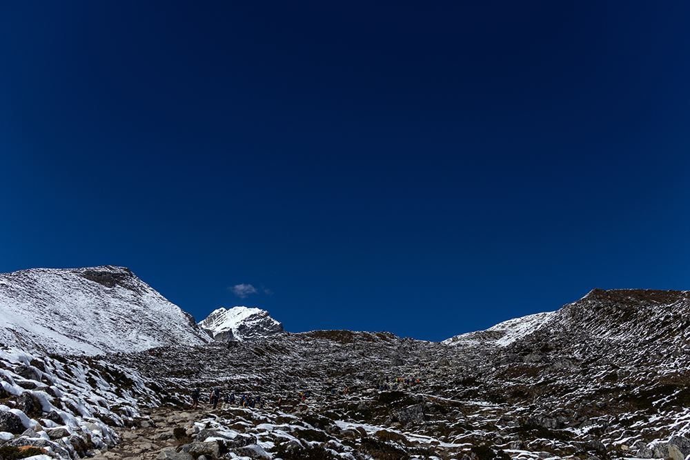
But with the bottom of the hill resting at 15,157 feet above sea level, and the top cresting at 15,846 feet, we had a grueling 688 feet (210 meters) of climbing ahead of us.
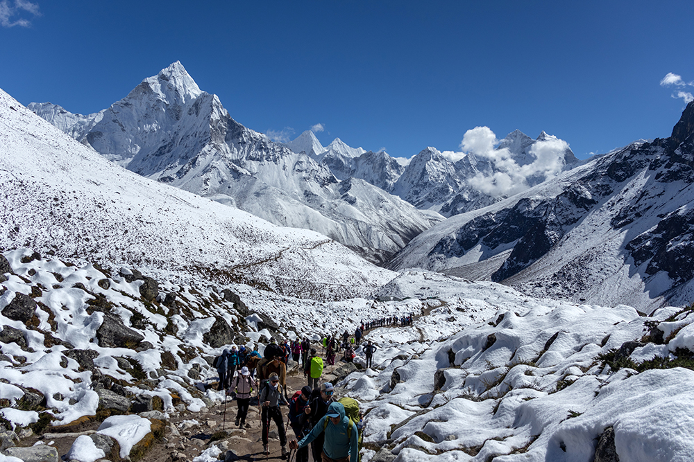
A snake of trekkers, guides, and porters sprawled out ahead of us. The hikers near the top of the hill could only be seen thanks to their brightly-colored jackets and backpacks. They looked so tiny from my perspective at the bottom of the hill. We moved as a group, making slow but steady progress upward. Rests were frequent, but I tried my best not to sit down when we stopped. I didn’t want to have to get back up again every time because every movement of my body felt three times as difficult as it would be at sea level.
Occasionally, a horse would pass by us, being led by a Sherpa and ridden by a trekker. We’d seen horses on the trail all along, but this was the first time I’d noticed trekkers riding them. Apparently they can be hired to ferry people over difficult terrain at high elevation. Part of me longed for a horse to carry me up the hill, but I gritted my teeth and kept a steady rhythm of “hard things are good for you” playing in my mind. The last thing I wanted was to not finish the trek under my own power. I’d spent months training for this, and I was determined to see it through.
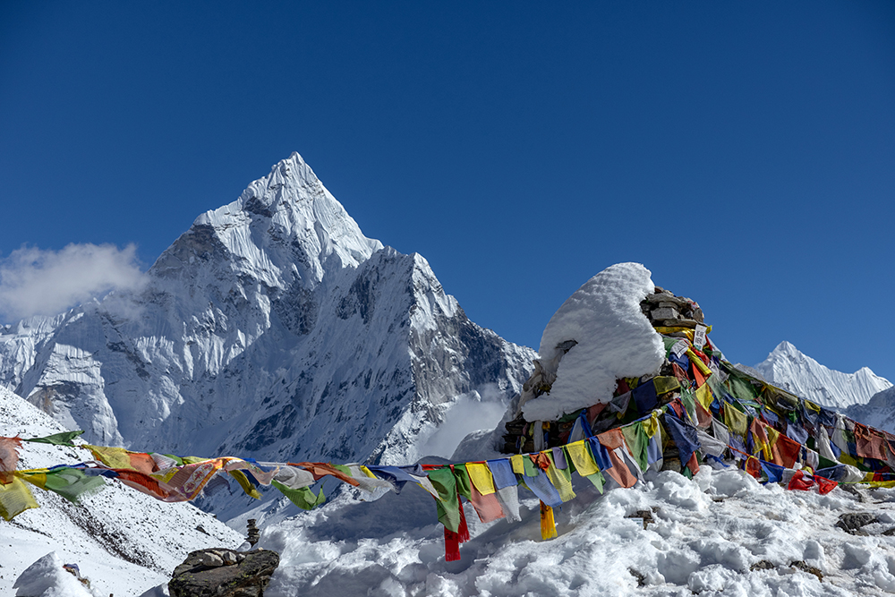
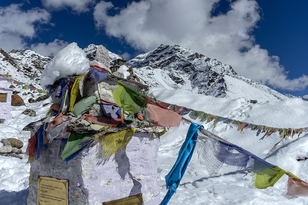
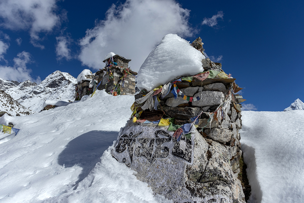
After what felt like an eternity of breathless steps, the team crested the hill, passing underneath a string of prayer flags that spanned across the trail. I was exhausted to my bones, but just as I was about to succumb to the temptation of sitting down for a few minutes, I noticed that the prayer flags we’d crossed under were hanging from a large, stone monument. We’d arrived at Thukla Pass, and the Climber’s Memorial.
The realization sent a jolt of renewed energy through my body. I joined the rest of my team in dropping our backpacks off at the side of the trail, so we could visit the memorial unencumbered. We left the trail and began walking amidst a labyrinth of snow and stone monuments. Each one was dedicated to one or more climbers who died while climbing in the Himalayas. These monuments were put in place by family members of the climbers and there is no set standard for what they have to consist of. Some of them were imposing structures with detailed plaques outlining the climber’s life and how they died, while others were as simple as a name painted onto a small rock.
As I walked between the stones, reading names, I suddenly felt very overwhelmed. My head was swimming as I came across the name Scott Fischer, and soon tears were streaming, unbidden, down my cheeks. I have no connection whatsoever to Scott Fischer, except that the disaster that claimed his life in 1996 was the reason I first learned about the existence of Mount Everest as a young child. It was a massive news story at the time, is the subject of Jon Krakauer’s bestseller Into Thin Air, and is still one of the most retold stories in mountaineering to this day.
Standing in a sea of names of people who were lost, exhausted of oxygen (and food) starved as I was, the sight of a name I recognized was all it took for my emotion to bubble up and spill out of me. Every name here was a person who was loved by their family and friends. Every name was also a person who had been willing to risk death by climbing in the Himalayas. The enormity of the impact of all of these lives felt all-consuming.
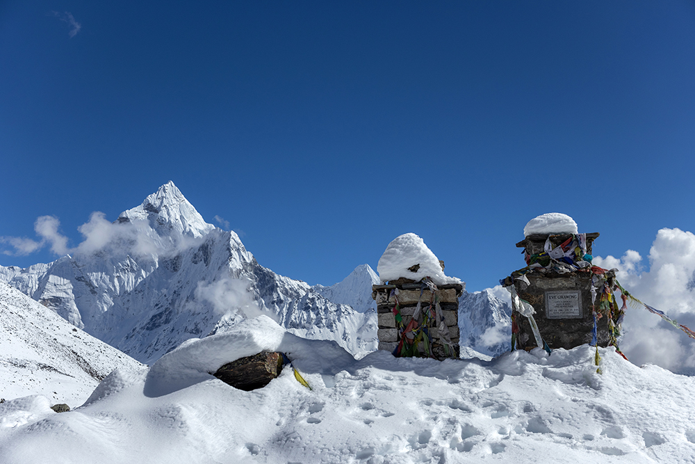
As I scanned my surroundings, blinking back tears, I thought I could understand why so many people are willing to risk everything to climb here. Pillowy clouds blended into icy peaks, which in turn blended into the blanket of snow that covered the memorial site. It was so unbelievably beautiful that I thought it might be as close to heaven as one can get on earth. But it was also profoundly sad, a stark contradiction that couldn’t be squared away neatly. It could only be felt.
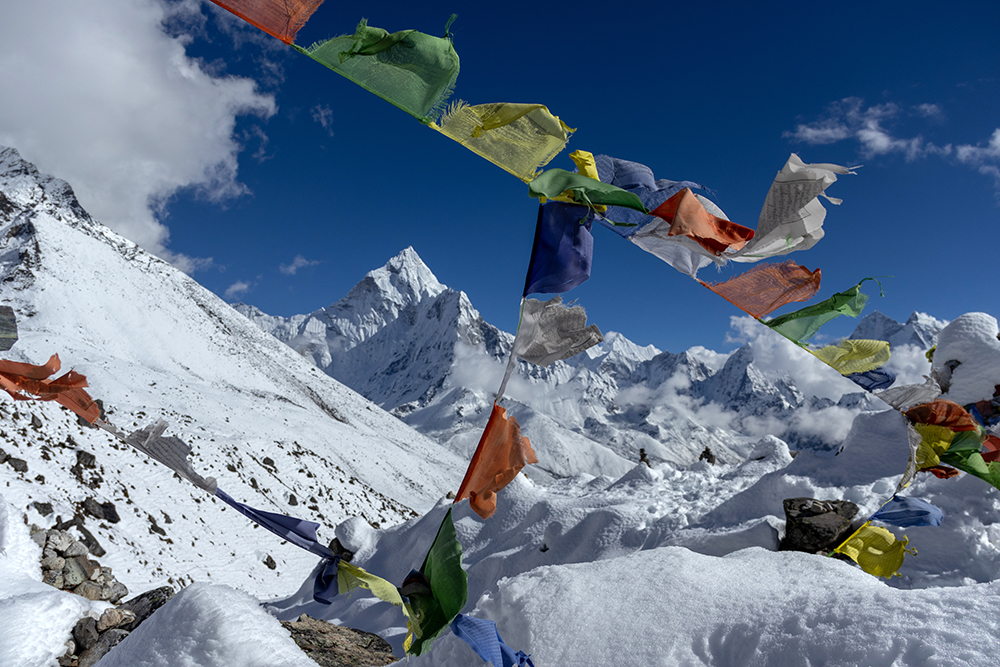
As we lingered at the memorial, time seemed to stop. Prayer Flags sighed in the wind, their mantras released and spreading across Thukla Pass. Stones stood, resolute in their memory of those who had given their lives for the mountains. And I silently cried.
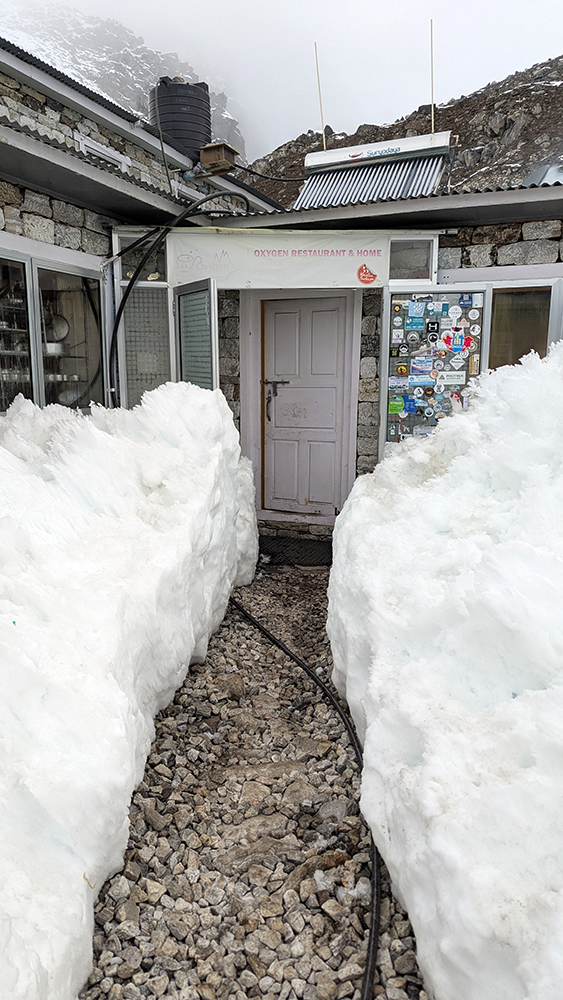
When we finally moved on from Thukla Pass, my unsettled feelings followed me. We had finished all of the aggressive elevation gain for the day, and I no longer needed to focus on the words “hard things are good for you” to keep me motivated. We walked alongside what looked like a wide and shallow river, but was actually part of the trail left behind when the Khumbu Glacier cut through the landscape. As we neared the village of Lobuche, fluffy dogs ran alongside us on the trail, almost as if they were leading the way to shelter and hot tea. Lobuche had apparently been hit hard during the recent storms, and as we approached our teahouse, the path was lined on either side with chest-high piles of snow.
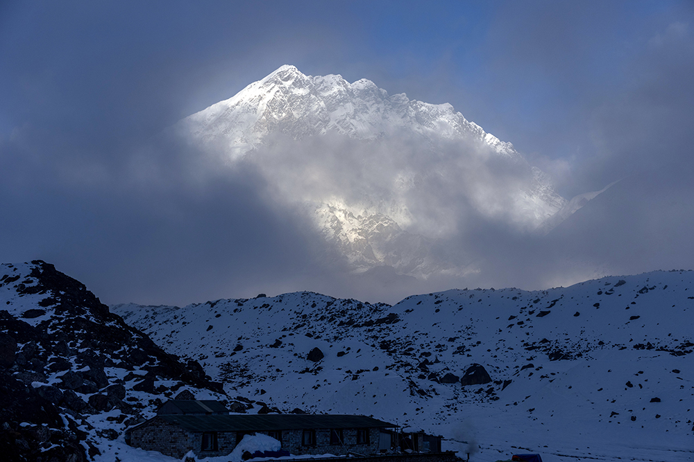
It felt amazing to sip hot tea while a yak poop fire burned in the stove that evening. As we settled in to our accommodation, I watched the sky turn to pastels over the distant form of Nuptse. Everest was somewhere just behind the shorter mountain, and tomorrow would be the day that we would finally stand at its base.
Before I slept that night, I reflected on the strong emotions I’d felt earlier. I couldn’t believe that in just a matter of days, I’d gone from wondering if the trek would ever feel difficult, to pushing up against physical limits I’d never tested before. I was glad that it was finally time to struggle. Part of the reason I’d come here was to find out if I could do it, and the next day would bring me my answer.
You can see more details of this amazing destination on my YouTube channel!


OMG, that was some snow leading to that restaurant! What conditions the locals live it, whereas here, we worry about whether a home has double glazing, and in my city it never snows.
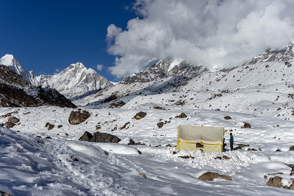
I was concerned when you wrote of pushing through despite signs of altitude effects. When I trekked, with just four women, plus guides, uphill for some days, I began to feel as if I was walking through concrete. I was advised to stay put for one night in my little tent, as the others climbed to Gokyo Lake, which lies at around 16, 000 feet. I was very sorry to have missed the spectacular views of the lake, but I have the memory of being virtually alone on a plateau, as if in an amphitheatre with high mountains surrounding me. It was magical. My group walked down the next day as we were on our last stretch before heading back to Kathmandu.
Your photos are amazing, and I love every one. I bet you never forget this trip.
It’s very snowy where I live right now, but we’re still comfortable and cozy. It’s hard to imagine living up in the mountains without a furnace or hot running water.
Thankfully, appetite loss was the only AMS symptom I developed (although that did catch up with me on base camp day). That’s so cool that you went to the Gokyo Lake area! I’d love to go back and trek there someday!
Thank you so much! Yes, this trip was unforgettable!