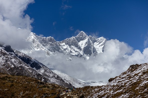
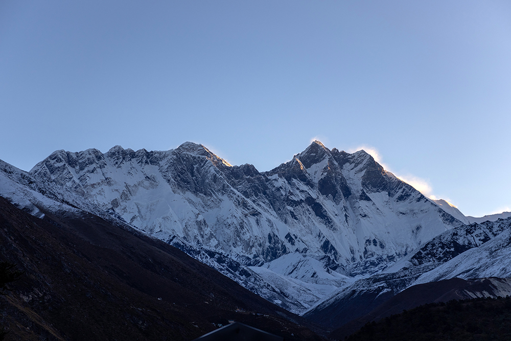
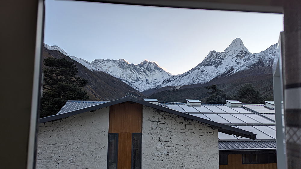
A serene silence hung in the air when I awoke at the first light of dawn in the village of Tengboche. It felt like the rest of the world was still sleeping peacefully, but when I crossed me and Vince’s room to ease open the window, the mountains in the distance told a different story.
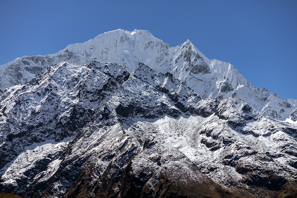
Ama Dablam, Lhotse, and Mount Everest stood tall, each outlined in an ethereal glow of golden light. I attached my long lens to my camera body to get a closer look, and found that the glow was actually windblown snow reflecting the sun’s light. My quiet morning was a raging wind storm up on the high peaks.
This deadly weather is why the fall season sees fewer climbers than the spring. According to the Himalayan Database, there were 47 Everest expeditions in 2025. All but three of them took place in the spring, and the three autumn expeditions were undertaken by elite level mountaineers.
In fact, just a couple of weeks earlier, Polish climber Andrzej Bargiel had become the first person to ever climb Mount Everest and then ski from the summit without the use of supplemental oxygen. He descended via the South Col route, even skiing through the infamously treacherous Khumbu Icefall just above Everest Base Camp. In a matter of days, Jim Morrison would become the first person to ever succeed in skiing down Everest’s north face via the Hornbein Couloir.
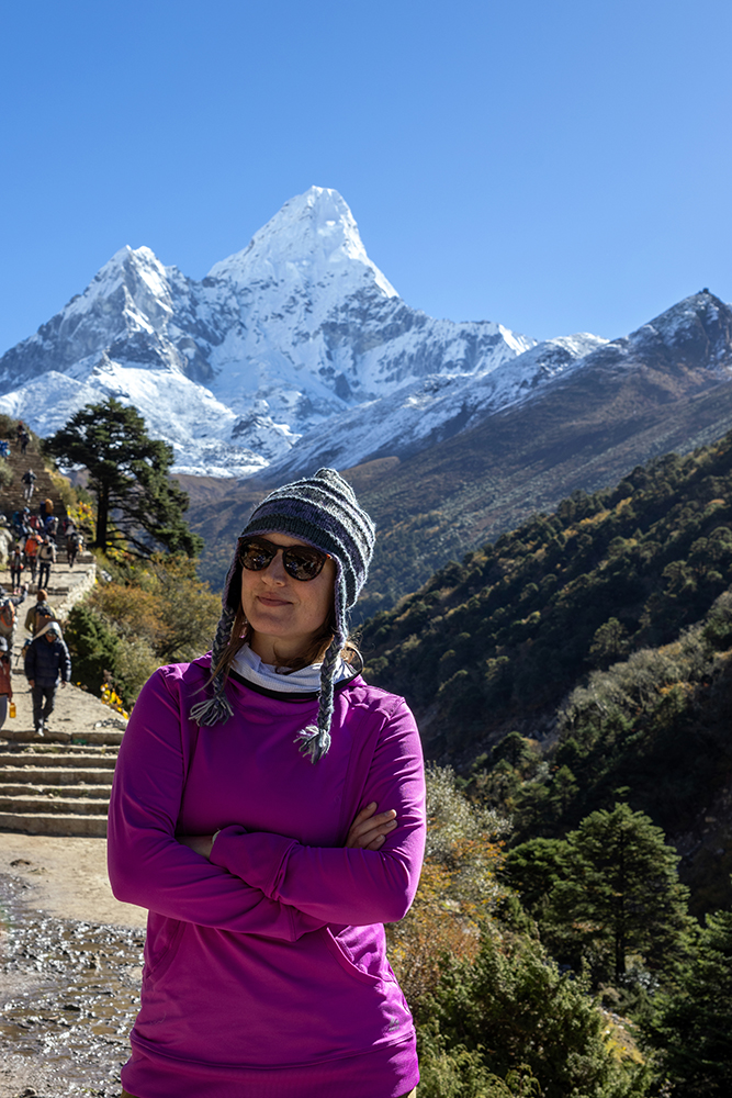
While the fall climbing season is reserved for the pros, autumn is high season for trekking, and the weather where we were at 12,687 feet (3,867 meters) was as good as it gets. I put on a puffy jacket and a lightweight sweatshirt to start the day, and after eating breakfast with our iTREK Everest team, we started walking.
We were headed for Dingboche whose elevation (14,470 ft/4,410 m) was just a couple hundred feet higher than I’d ever climbed before. I wondered what walking would feel like at that elevation and above. More than that, I wondered what simply existing would feel like up there. So far the elevation on our trek had had little effect on me, and while hiking uphill was certainly tiring, I was beginning to wonder if the trek was ever going to get really hard. In my mind, I imagined the 14,000 foot mark as some sort of invisible border separating the known from the unknown. Tomorrow would be the first real test of the trip.
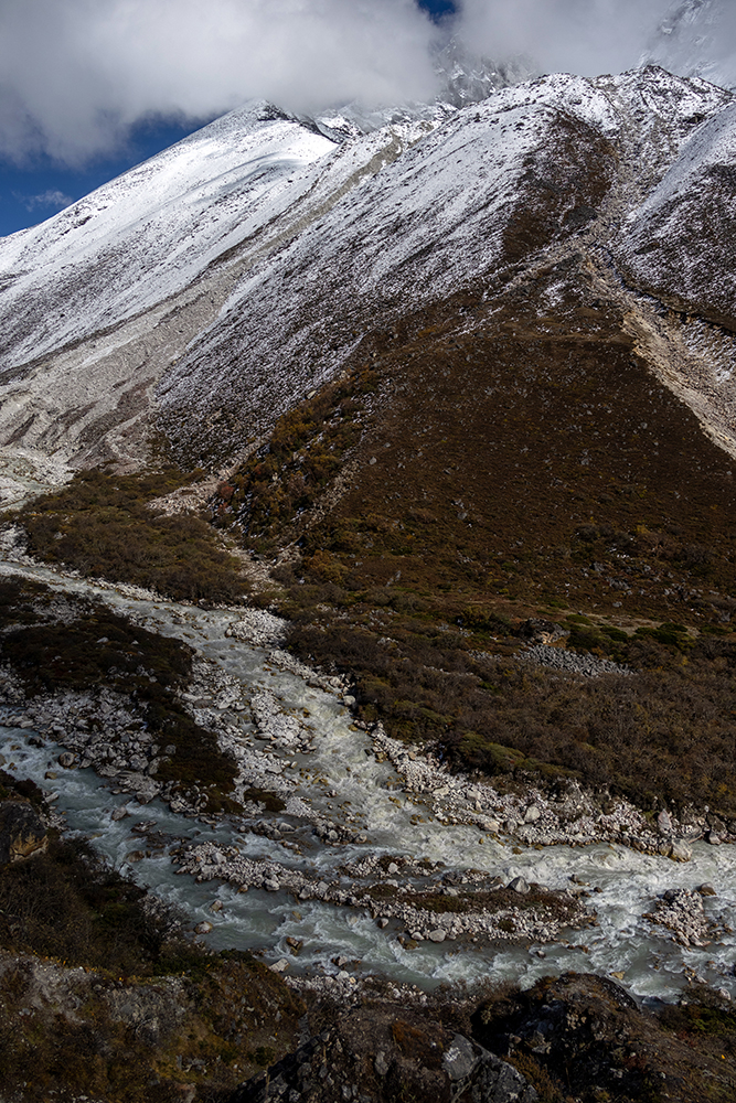
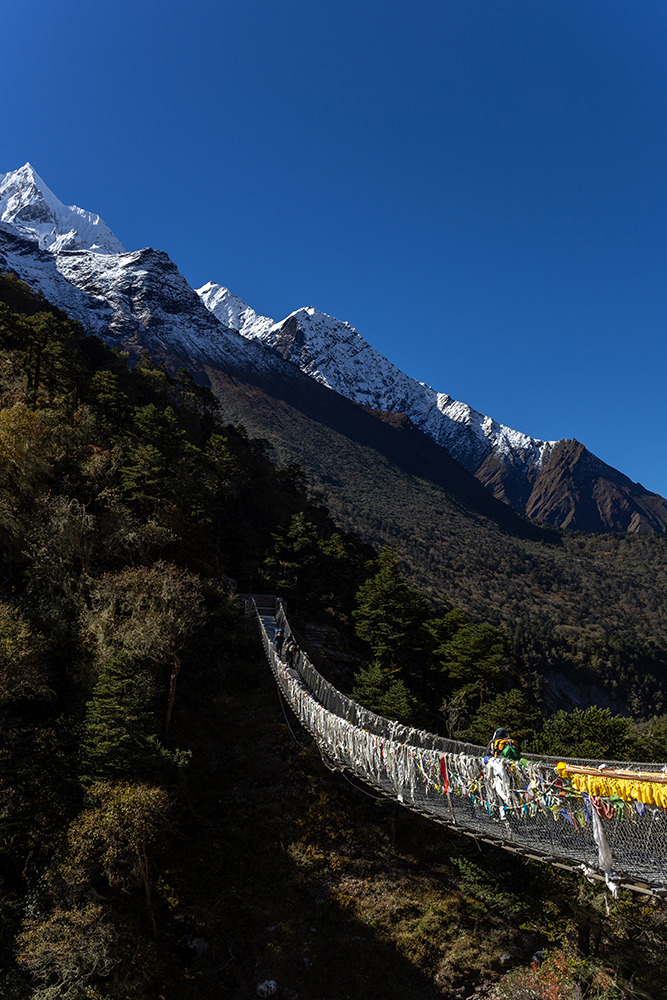
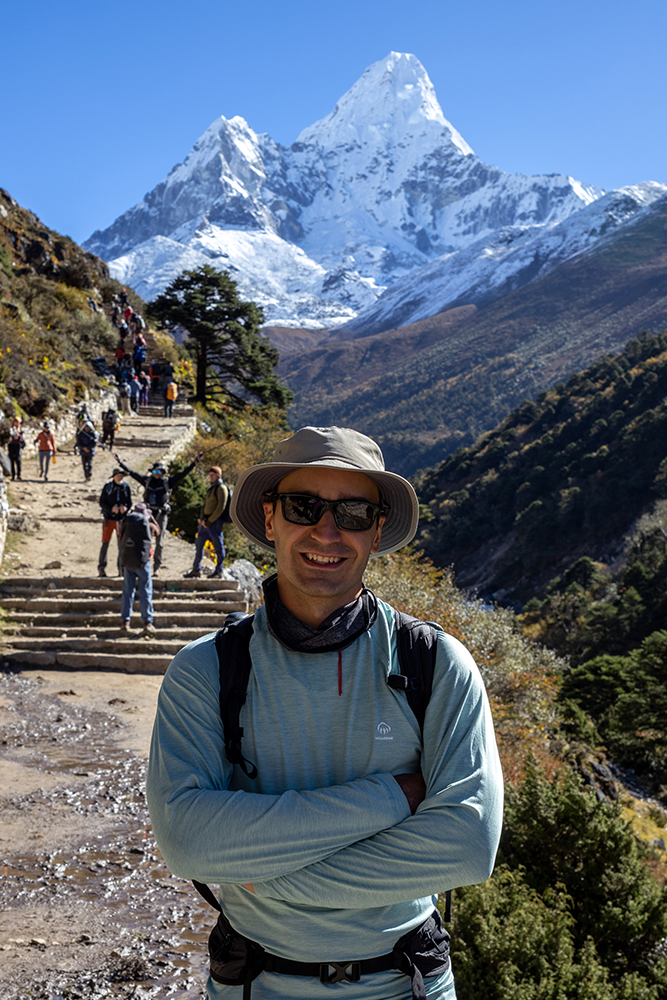
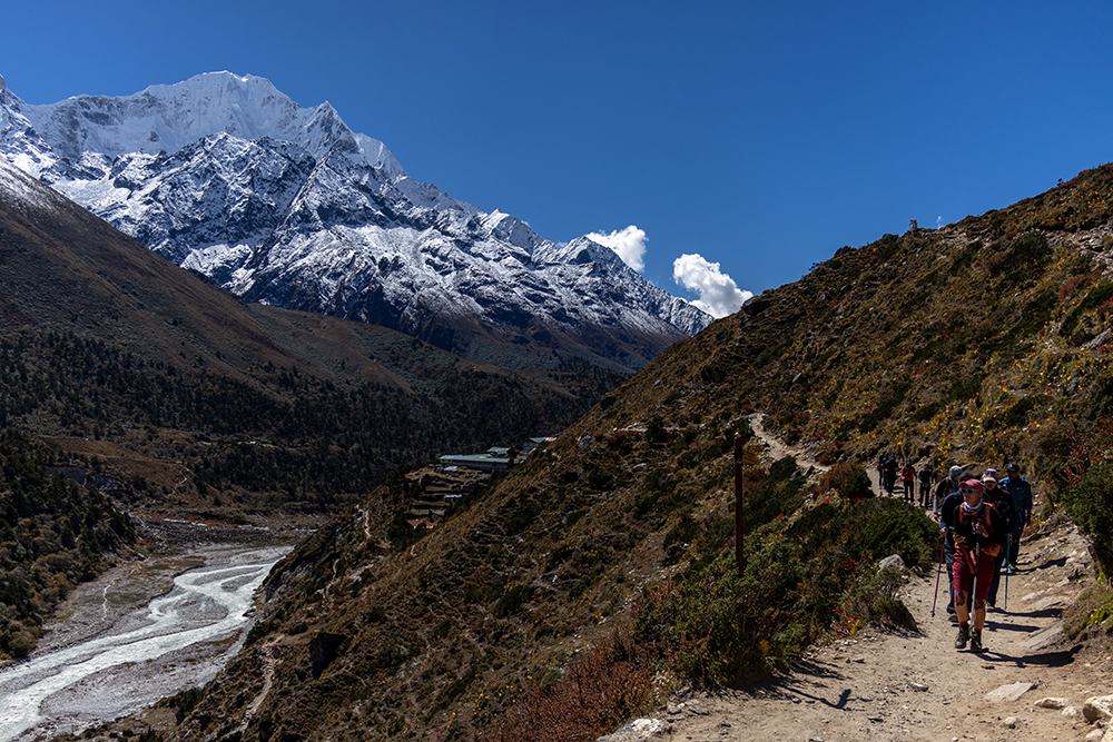
But for now, I didn’t have to worry about the altitude quite yet. We began the day by descending down a steep hill, and at the bottom we crossed a suspension bridge that spanned a dramatic gorge. Prayer flags that hung from the bridge wafted in a gentle breeze as we crossed the river, and on the other side, we took a break to drink some water and admire a stunning view of Ama Dablam. Porters and trekkers walked up and down the trail underneath the looming peak, which seemed almost close enough to reach out and touch now.

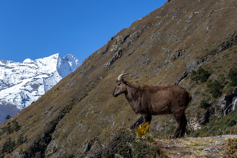
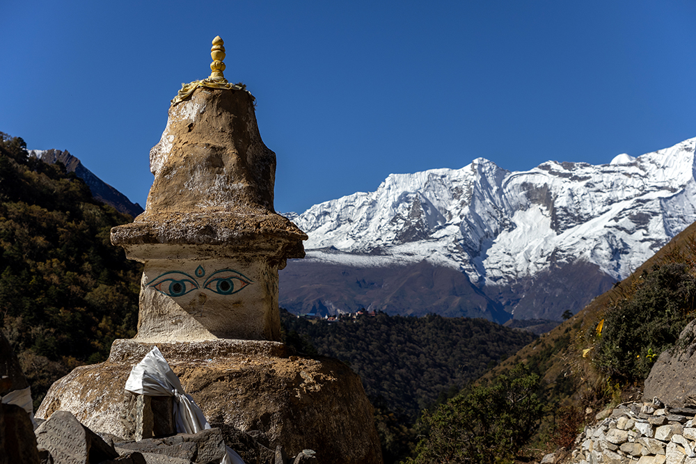
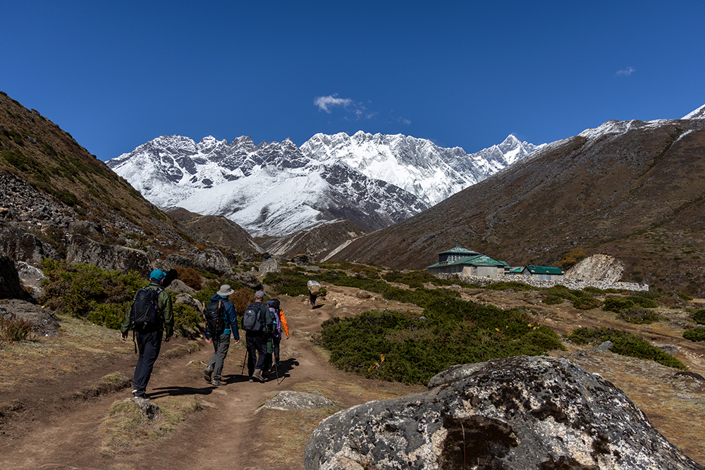
Trees were becoming scarce as we ascended ever higher through the Khumbu Valley, and I soon found myself shedding layers and optimizing for sun protection instead of warmth. There wasn’t a cloud in the sky, which meant that we had perfectly unobstructed views of the mountains as we hiked. It wasn’t long before we came upon another picturesque scene. A Himalayan Tahr stood stock still above the trail, silently observing as a group of trekkers passed beneath a Stupa painted with Buddha’s Eyes. In the background, Ama Dablam mirrored the Stupa’s pyramid-shaped shaped spire. The goat, the Stupa, and the mountain all seemed to be impassively watching as the trekkers climbed upward on labored breaths.
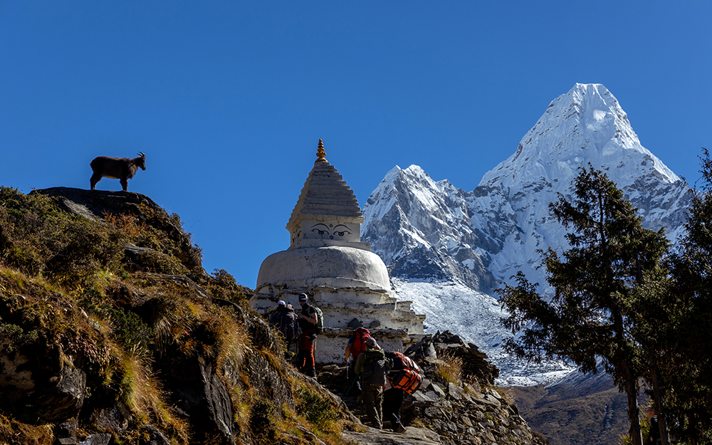
We stopped briefly to look at the tahr after we climbed passed the Stupa, and a strange sensation that I was watching the watcher came over me.
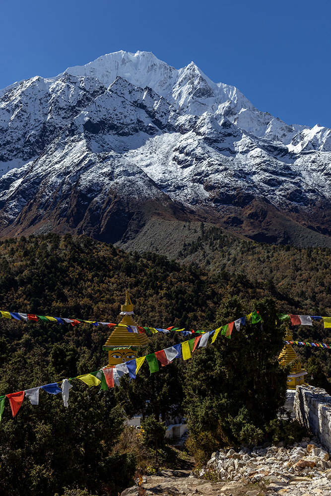
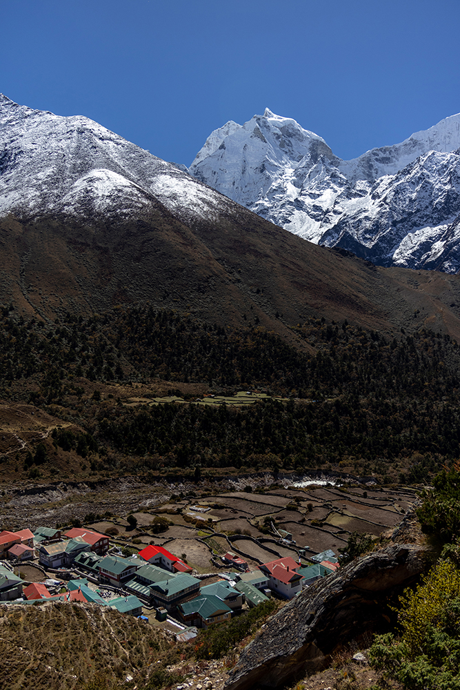
Shortly after this chance encounter, we veered from the main road to make a detour up to Pangboche. This meant climbing an extra hill, but when we reached the village, we would get the opportunity to visit a very special monastery.
The steep trail was strung with prayer flags and dotted with Stupas. Occasionally, a free ranging yak would lumber across the trail and then continue grazing on scrubby plants.
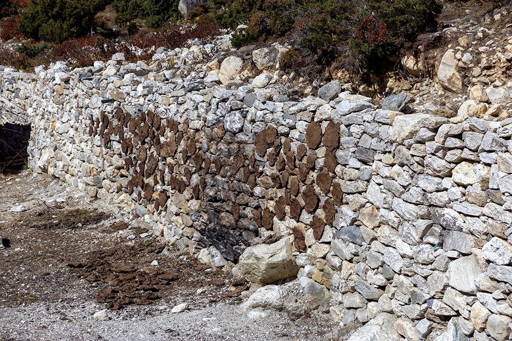
We also started to see areas where people had spread patches of yak poop out to dry. This is a substitute for firewood at high elevation where trees are scarce to non-existent. In fact, all of our teahouses moving forward would be heated by yak poop. As you can see from the photos, Pangboche is still at a low enough elevation for trees to grow, but there is a ban on burning wood there, so the villagers use alternative fuels.
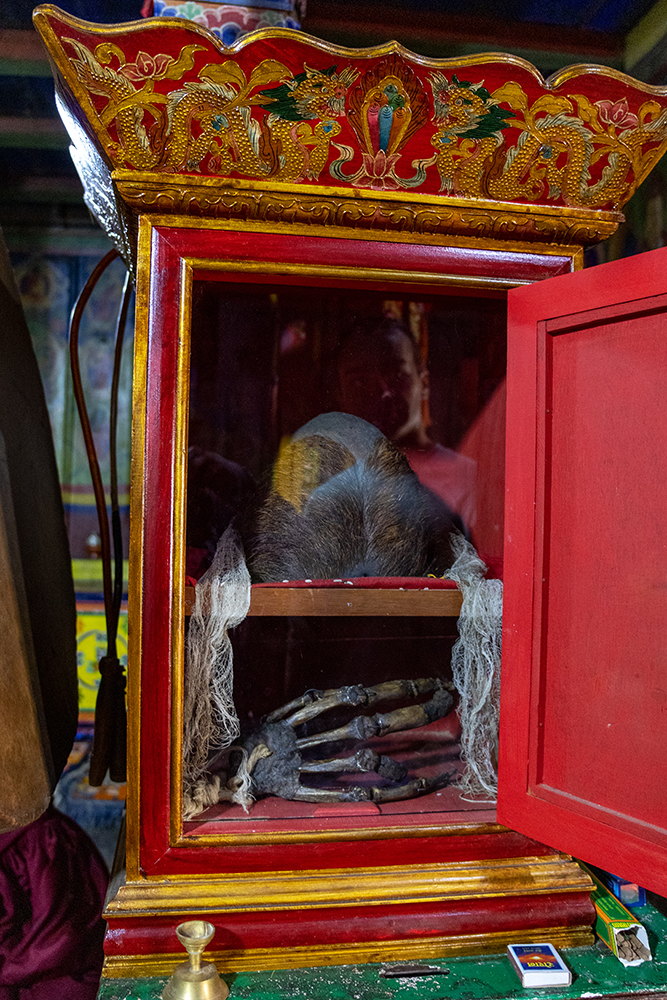
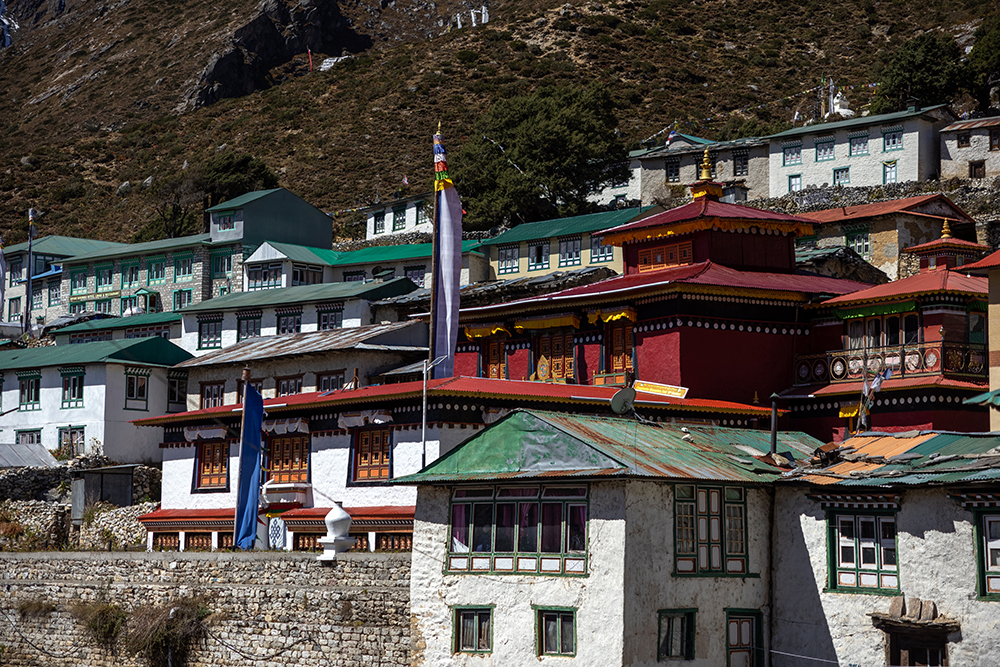
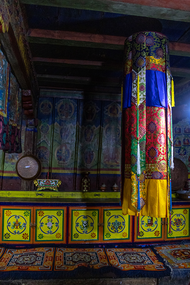
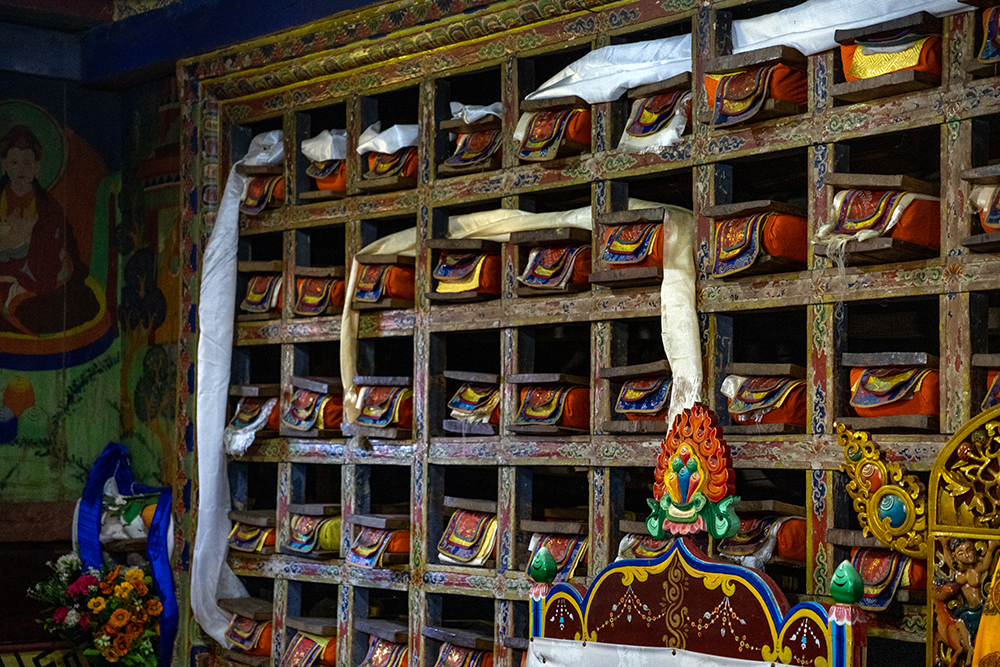
Now that we’d arrived in Upper Pangboche, it didn’t take long to reach the Pangboche Monastery. This monastery is important because at around 600 years old, it is the oldest one in the Khumbu region. We all took off our shoes before going inside the monastery to learn a bit about its history. Photography is typically prohibited inside, but the monk that was on duty gave me permission to take some, and I’m very glad to have some pictures to remember our visit.
I could feel the cool wood of the monastery’s floor through my socks as we entered. The floor was completely smoothed out and darkened with age. Colorfully painted statues surrounded an altar at the center of the room, and a detailed mandala decorated the ceiling above us. The power was out when we first entered the monastery, which made me feel as though we’d actually stepped back in time a couple of centuries. But eventually the lights flickered back on, making the paintings and statues around us look even more vibrant.
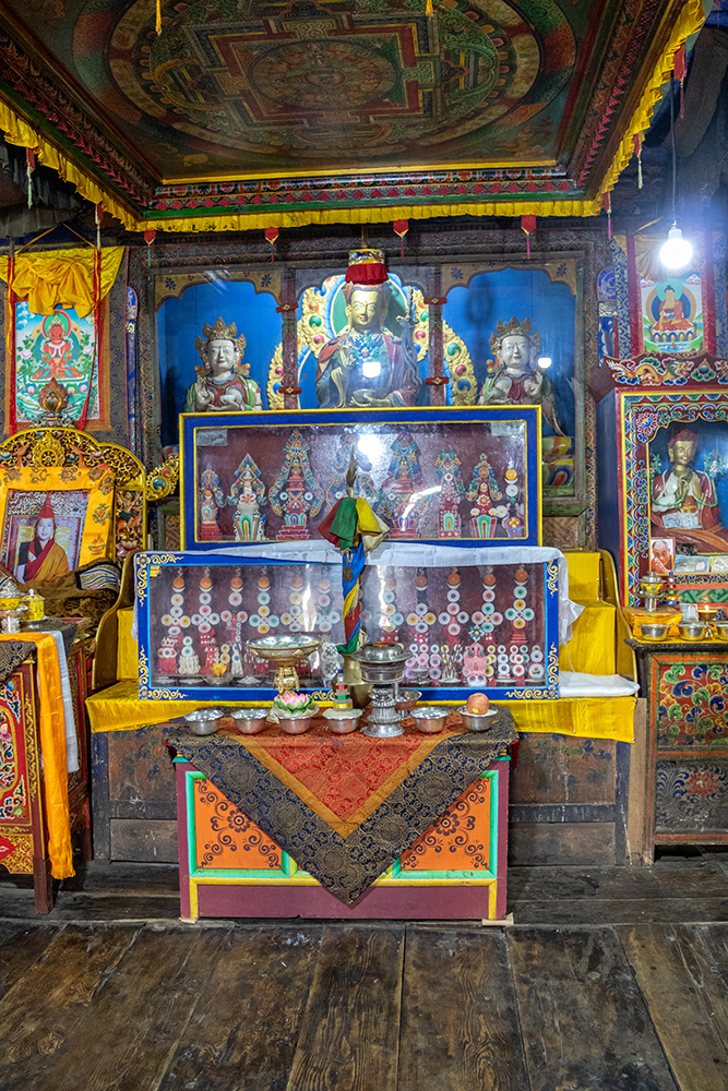
As we all looked around the room, trying to take in every detail, PG taught a bit about the monastery’s history, and about Tibetan Buddhism. We learned that the Pangboche Monastery was built by Lama Sangwa Dorje, who is also known as the Flying Lama. It’s said that he used to fly around the Khumbu area, and that a yeti would help him with chores around the monastery while he meditated. The yeti died in an avalanche though, and its skull and hand were brought back and preserved inside the monastery. At the back of the room, there was a decorated display case that still houses these artifacts, although I’ve read that these are replicas. The original hand and skull were stolen in the 1990’s, although pieces of the hand were already allegedly stolen in the 1950’s, an odd story that involves Jimmy Stewart of all people.
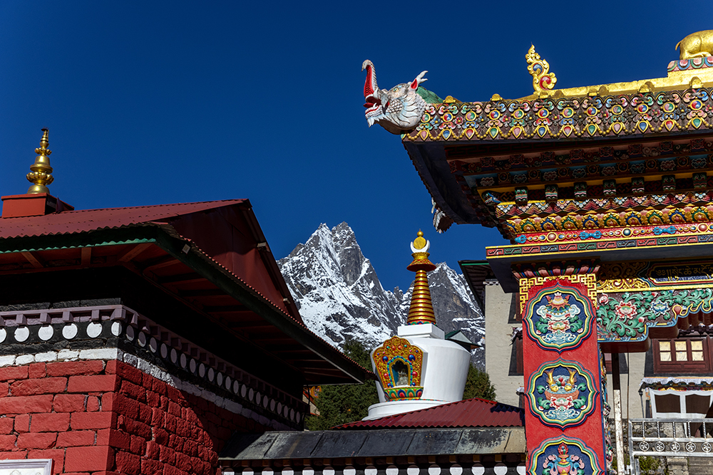
PG also taught us that the colors of the prayer flags we’d seen throughout the trek represent the five elements, blue for the sky and space, white for air and wind, red for fire, green for water, and yellow for earth. The monk also gave us more red strings to tie around our necks for luck. I added mine to the one I’d received at the Tengboche Monastery the night before.
After our visit to the monastery, we stopped for tea at a real Sherpa teahouse, which was a bit different from the teahouses we were staying at along the trail that were built specifically for tourists. This teahouse was smaller, and felt more lived in and cozy compared to the large central rooms in all of the trekker’s teahouses. I ordered a lemon ginger honey, which was quickly becoming my tea of choice as the mountain air dried out my airways. When we finished our drinks, we stepped outside for one last view of the monastery and the village. Pangboche was incredibly quiet compared to the busy trail. There were no other trekking groups in town at the same time as us, and it had been nice to get away from the crowds for a bit and see more of the local culture.
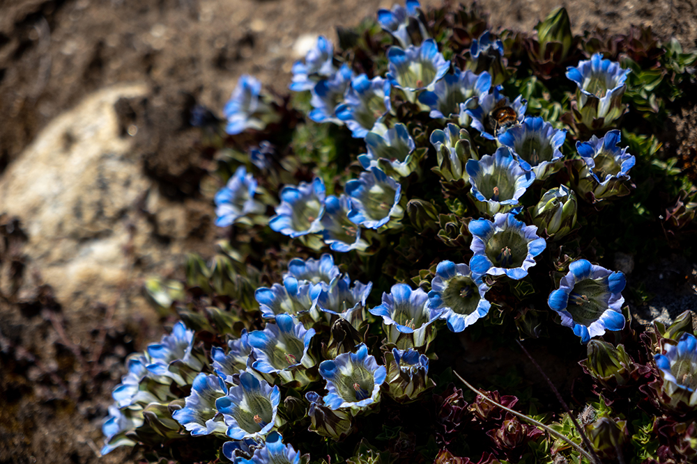
On our way out of Pangboche, we passed by a fork in the trail, where one path led downhill and the other up. The group followed Mahesh along the higher of the two paths, and soon, we emerged from a juniper forest to find a sprawling view of the mountains, and of Lower Pangboche in the valley below us. The vegetation below the trail was crisscrossed with paths worn down by grazing yaks that wandered through the fields, and blue gentiana flowers grew in mats along the trail.

The scene was nothing short of idyllic. That is until Mahesh, typically a man of few words exclamed, “Oh, s***, Sandy!” before running back in the direction we’d come from, indicating that the rest of us should stay put.
Our remaining number did a quick head count and came up with six people where there should have been nine. Sure enough, Sandy was missing, and PG had presumably also gone after him.
The six of us exchanged looks of concern, until a text from Sandy came through to Kennedy’s phone and she read aloud, “Lost you guys.”
A short while later, a tall figure appeared on the other trail about 70 vertical feet below us. Sure enough, it was Sandy. Apparently he’d taken the other path back at the fork. Within a few more minutes, Mahesh had caught back up with us, breathing heavily from running. He reclaimed his position at the front of the group, leading us along the trail until it converged at another fork, where Sandy and PG were sitting on a bench waiting for us.
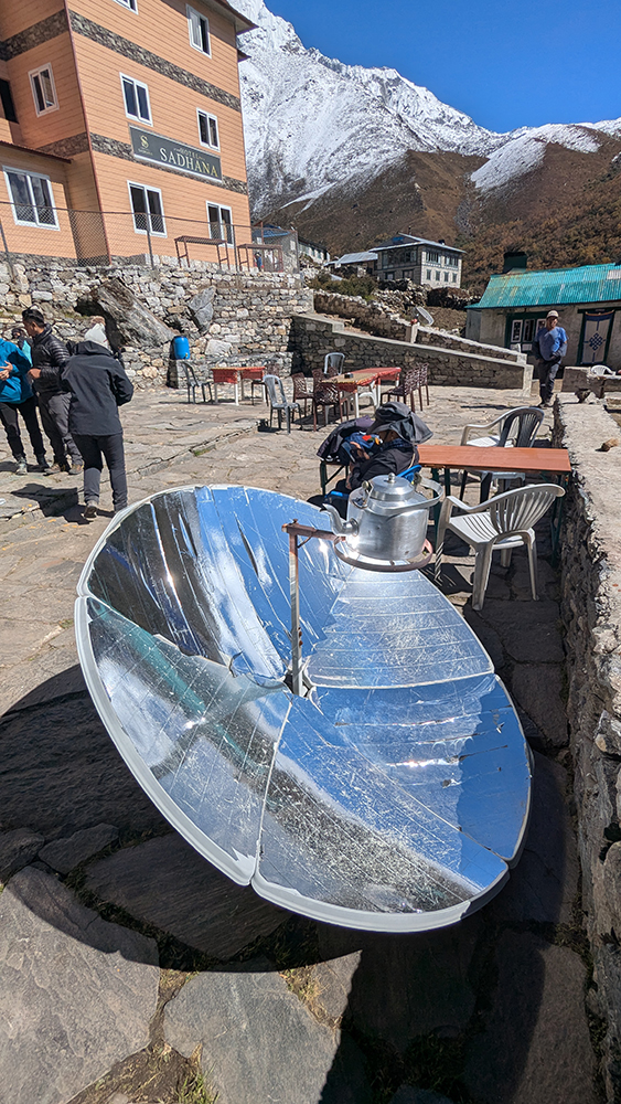
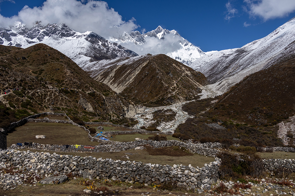
With that crisis averted and the whole group reunited, we walked a bit further and then stopped for lunch in the village of Somare. As we entered the village, we noticed tea pots set up outside of buildings on large reflective disks that looked a lot like satellite dishes, a rather ingenious method of boiling water (and much favorable to heating it over yak poop I might add).
Inside the restaurant he’d chosen, PG put in orders for us all to have the tea house’s set lunch, and then took our individual drink orders. I went out on a limb and ordered seabuck-thorn juice, an item I hadn’t seen on any other menus so far. It’s a local juice made from wild berries that grow in the Himalayas, and when it arrived I saw that it was bright orange in color. I took a sip and my entire face immediately scrunched up because the juice was intensely sour. PG admitted that he isn’t a fan of the flavor himself, and kindly let me order another drink. I laughed and passed the drink around so everyone else could try it if they dared.
Aside from the sour juice, the set lunch included fried veggies and noodles, and we got our first serving of garlic soup, which is popular along the trail because it’s thought to help with acclimatization. The garlic soup was much more to my liking, and I gladly downed my entire bowl, ignoring what my breath would smell like afterwards. If I had known that this would be the last meal where I would actually have an appetite, I might have made more of an effort to finish off the noodles as well.
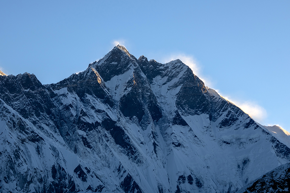
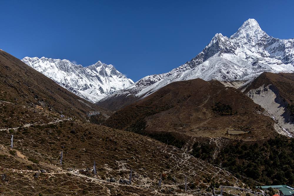
After lunch, we donned our day packs and set out on the last, and most beautiful, leg of the hike for the day. From here on out, the trail was relatively flat, with just a gradual incline as we walked alongside the Imja Khola River, a tributary that is fed by the Imja Glacier. Along the way, we could see Lhotse and Ama Dablam, although cotton ball clouds began to form, shrouding the mountains from view.
Along the way we began to encounter patches of snow, and even had a brief snowball fight, which ended in fits of laughter on labored breaths.
As we hiked I noticed that I was having an easier time at this elevation than I’d expected. Vince and I had trained on a few mountains in Colorado a month before the trip, summiting a thirteener and two (three for Vince) fourteeners over a long weekend. Suffice it to say, I’d found reaching this elevation in Colorado to be much more challenging. That was surely down to a couple of factors. For one thing, we’d had basically no acclimatization on the Colorado trip. We’d gone straight from Michigan (640 ft/195 m) to mile-high Denver and just hoped for the best. For another thing, we’d all been taking a half dose of diamox a day to try to make up for missing our acclimatization day in Namche. Apparently these things were working, because so far, I felt amazing.
Afternoon was sinking into evening by the time we crested one last small hill to find that Dingboche was right below us. A thrill of excitement shot through me. We’d made it to the 14,000 foot threshold, and everything after this would be unpredictable.
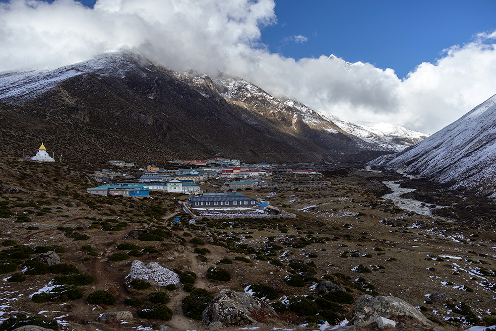
A bone-chilling cold settled over the valley as we followed PG through the muddy streets of Dingboche. A stream had formed on the main street of the village because of snow melt from the recent storm, so we hopped from one side of the water to the other, dodging loose yaks as we went.
When we finally reached our teahouse, I immediately dug my new goose down jacket out of my duffel bag and bundled up. One thing was for sure, there would be no more showers for me until we got back down to a lower elevation. It was way too cold up here to be walking around with wet hair.
Vince and I didn’t linger in our room for long, opting instead to hang out in the teahouse’s dining room where it was a bit warmer. We chatted with other trekkers until our food came out, and then I tried my best to get a good portion of my dinner down, only to find myself absent-mindedly pushing noodles around my plate. I supposed I had eaten a good portion of my lunch, and that’s why I wasn’t feeling very hungry. Little did I know, that this was a sign of what was going to come over the next few days. For the moment, I was blissfully ignorant, and felt optimistic about how well I’d performed so far, as I passed off my barely-touched plate for Vince to finish.
That night I drifted off to sleep thinking, “I wonder if this trek is even going to get hard,” I would have a definitive answer by the next morning.
You can see more details of this amazing destination on my YouTube channel!


Great to revisit this area via your images. Up to this point, approximately home many hours did you trek each day? We walked past the entrance to the Everest Base Camp, so I am thinking you got to climb some once you went into this area. Looking forward to reading more.
I’d say we walked about six or seven hours a day at this point. After we left Dingboche, we were out longer, but we didn’t do any serious climbing.