
Life’s a bit like mountaineering – never look down.
~Edmund Hillary
With the daunting landing at Lukla’s Tenzing-Hillary Airport now a thing of the past, it was time for our team to begin our trek to the base of Mount Everest. I for one, could hardly wait to get going. As we followed our guide, PG, out of the airport and onto the streets of Lukla, I felt an odd mixture of excitement and apprehension. This was a journey I’d wanted to undertake for years, but I had my doubts about my own ability to complete it. After all, I’d never climbed higher than 14,000 feet (4,267 meters) before, and Everest Base Camp lies at a whopping 17,598 feet (5363 meters). Realistically, I had no idea how I would respond to that kind of altitude. It would just have to remain to be seen.
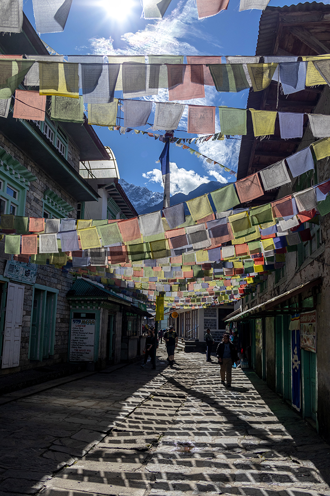
But for now, I pushed my doubts out of my mind because the bustling main street of Lukla was demanding my attention. The street was lined with shops selling trekking gear, snacks, and souvenirs. I was tempted by a t-shirt that read “Dhal Bhat Power 24 Hour.”
When I remarked that I liked the shirt, PG laughed and sang a little tune of, “Dhal Bhat power 24 hour, no shower, smell like a flower.” Surely a portent of things to come as we ascended higher into the Khumbu Valley.
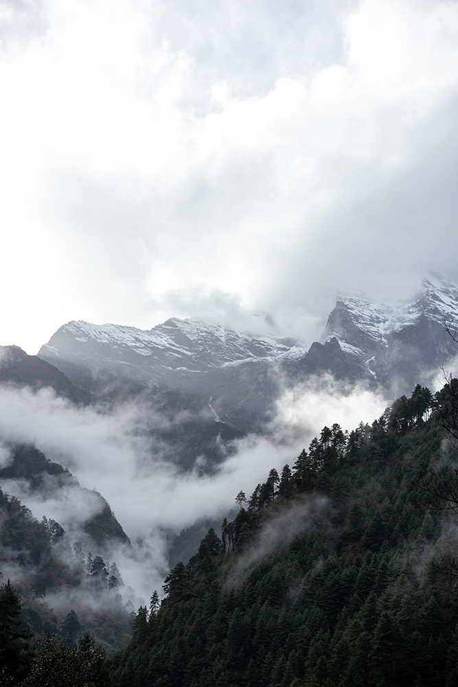
In addition to all of the little shops, my attention was captured by a view of an imposing, snow-capped mountain that loomed above the village. The mountain was a reminder that while it may be a sunny and energetic day down in the village, the environment here was savage just a little higher up.

A little ways into town, PG ushered us into a cafe where we ordered hot drinks while we waited for the rest of our team to arrive. A short while later we met our second guide, Mahesh, and our three porters, Deraj, Moti, and Kamal. They would be the true backbone of our team, because without them, our success would be impossible. At the elevations we were headed to, there’s no way any of us could carry a 10 kg duffel, let alone the 2-3 duffels each porter would carry.
With the team finally complete, we paid for our drinks, set off on the trail, stopping to take in the sights until we crossed under the Pasang Lhamu memorial gate and exited the village.
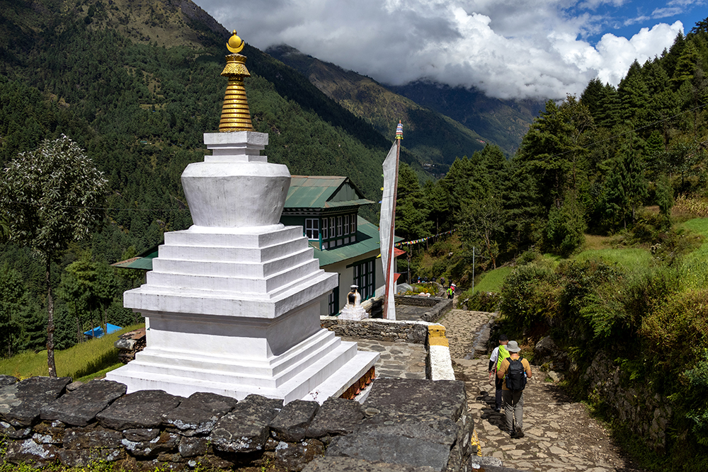
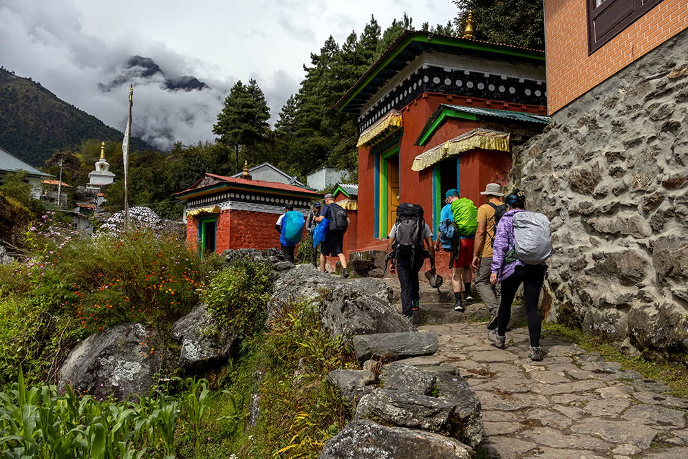
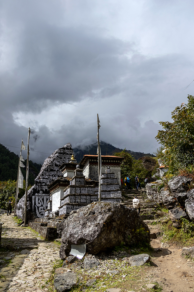
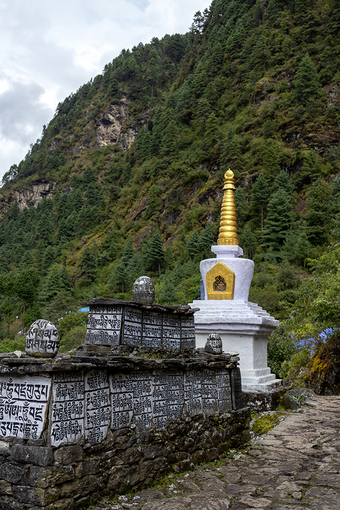
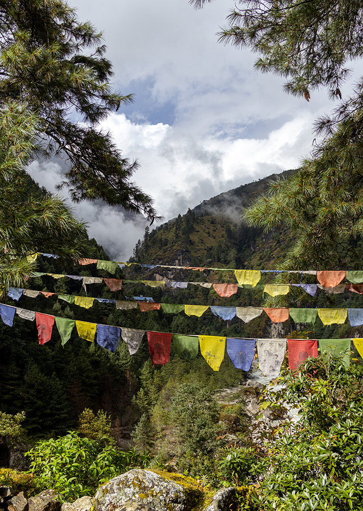
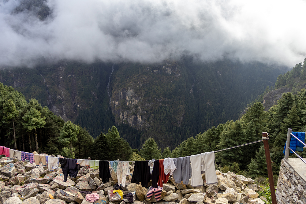
The first day of the trek would be by far the easiest. It was a short day, and almost entirely gentle, downhill terrain. I appreciated this because it was a good opportunity to ease into hiking after spending the past four days sitting around in airports, planes, and a very cramped van. Beautiful Stupas dotted the trail every so often. We also passed many Prayer Wheels and Mani Stones along the trail, and PG taught us to spin the Prayer Wheels in a clockwise direction, and always pass by the Mani Stones on the left side.

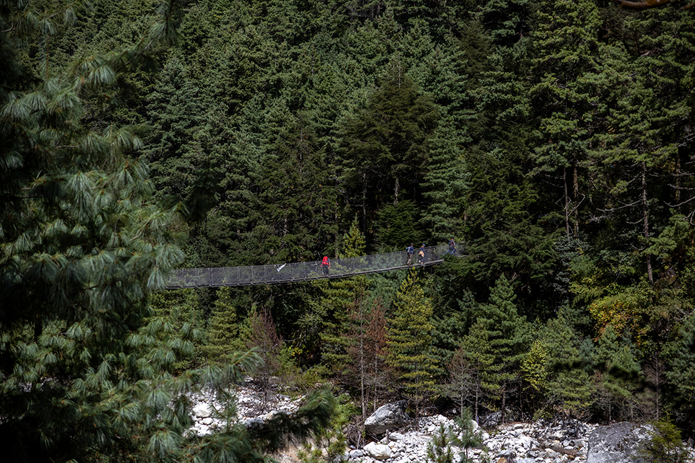
Before long, we came to our first suspension bridge of the trek. We would have to cross over several of these metal bridges over the next few days, and I was pleasantly surprised at how sturdy the bridge was when I stepped out onto it. I looked down at my feet as I bounced along the bridge, and I could see water rushing far below through the slatted metal.
It was funny. When I’d imagined myself crossing my first suspension bridge, I’d always thought it would be a bit scary. Now that it was actually happening, I felt nothing but excitement. My quads burned as I hoofed it up the upward sloping section of bridge at the end, and then my feet hit firm ground. One bridge down, many more to go!

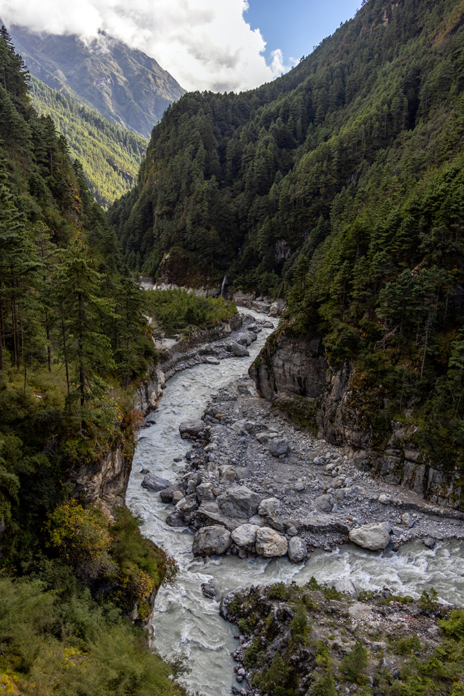
Not long after this, we crossed a picturesque section of river, whose turquoise waters toppled over smooth boulders. On the other side, we climbed a steep hill, and at the top, we stopped for lunch.

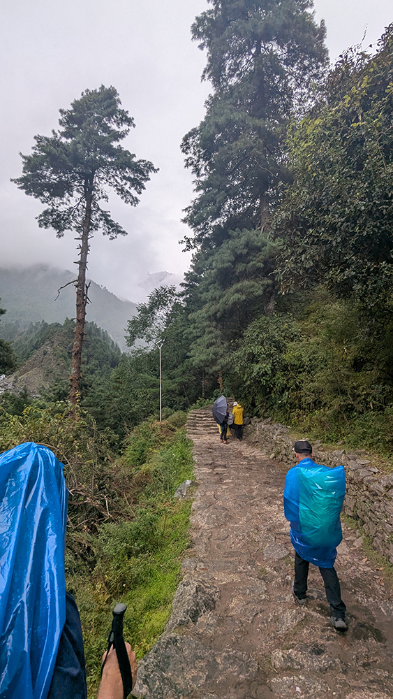
As we ate, thick cloud cover settled over us, and within minutes, thick rain drops began pelting the roof of the restaurant we’d stopped at. Luckily Vince, Thadd, and I had packed our rain jackets and rain flies for our backpacks with us that morning, but a few other members of the group had left their rain gear in their duffel bags. Thankfully, PG and Mahesh knew exactly what to do. They fashioned a few makeshift ponchos out of large sheets of plastic, and then we were off, hiking through the rain. The downpour didn’t last long, but based on the clouds that still gathered overhead, I guessed that we hadn’t seen the last of the bad weather yet.
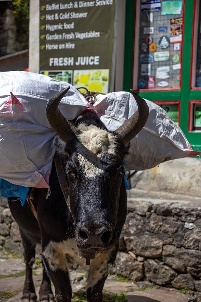
Just as the rain eased up, we encountered our first train of yaks, or rather half yak/half cow hybrids. They were transporting goods between villages, and their arrival was portended by a gentle ringing of cow bells. The sound gave us enough warning to all get over to the mountain side of the trail so we wouldn’t be toppled down the slope as the large animals lumbered passed us. The yaks became a common sight along the trail, along with mules and horses, and I was happy to see them every time they appeared.
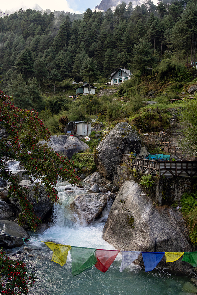
Even though it wasn’t currently raining, we all kept our jackets on as we neared Phakding, and just as we entered the village, it started to pour again, this time even harder. Rather than keep walking, we ducked into a nearby teahouse whose owner was related to Mahesh. Inside, we ordered a round of lemon ginger honey tea, and sipped the piping hot drinks until the rain stopped.
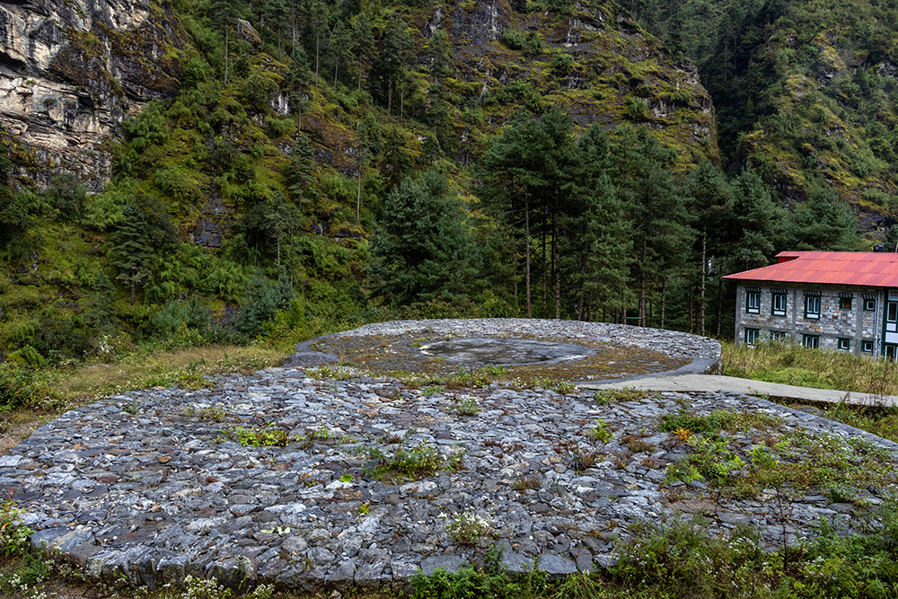
We were technically scheduled to stay in Phakding for the night, but PG favored the idea of walking a bit further to get a head start on tomorrow’s hike. So we walked another half hour or so to the village of Tok Tok. There we checked into our tea house, and settled in for the evening. Since it had been such a short day, we had plenty of time to check out the views of the surrounding valley and mountains before dinner. The tea house had a helipad right out back, which was a somber reminder that a helivac could become necessary if any of us came down with serious altitude sickness.
That evening, we congregated in the teahouse’s restaurant where we got to know our teammates a bit better over dinner. The power flickered in and out as we talked, and a wood fire kept the room warm. Eventually we all retreated to our rooms for some sleep. The next day would be significantly more strenuous, so it was important to be well-rested.
I woke up with the sun the next morning, and after a bit of drama with our floor’s bathroom (a pipe was spewing water to the point of causing a minor flood), I snuck outside to enjoy the peace and quiet for a moment before breakfast. That quiet was momentarily interrupted by the sound of a low-flying helicopter, which I would get used to over the next several days. Helicopter flyovers only increased in frequency the higher we climbed. Soon, I joined the team for breakfast, and then we hit the trail, bound for the iconic trading hub, Namche Bazaar.
It was a brilliantly sunny morning, and Vince took the opportunity to debut his portable solar panel, which ended up working great to charge our power brick along the trail. Of course, this wouldn’t have been so successful if the weather stayed anything like it had been yesterday, but as it happened, we enjoyed blue skies and sunshine for the remainder of our trek.
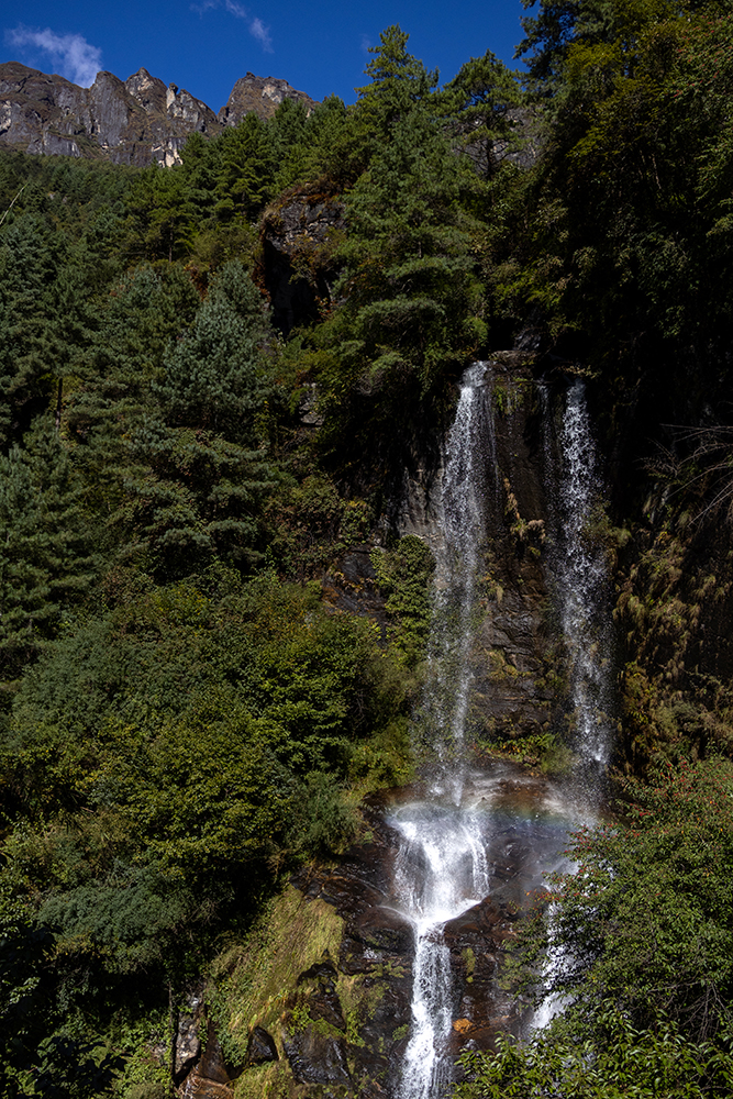
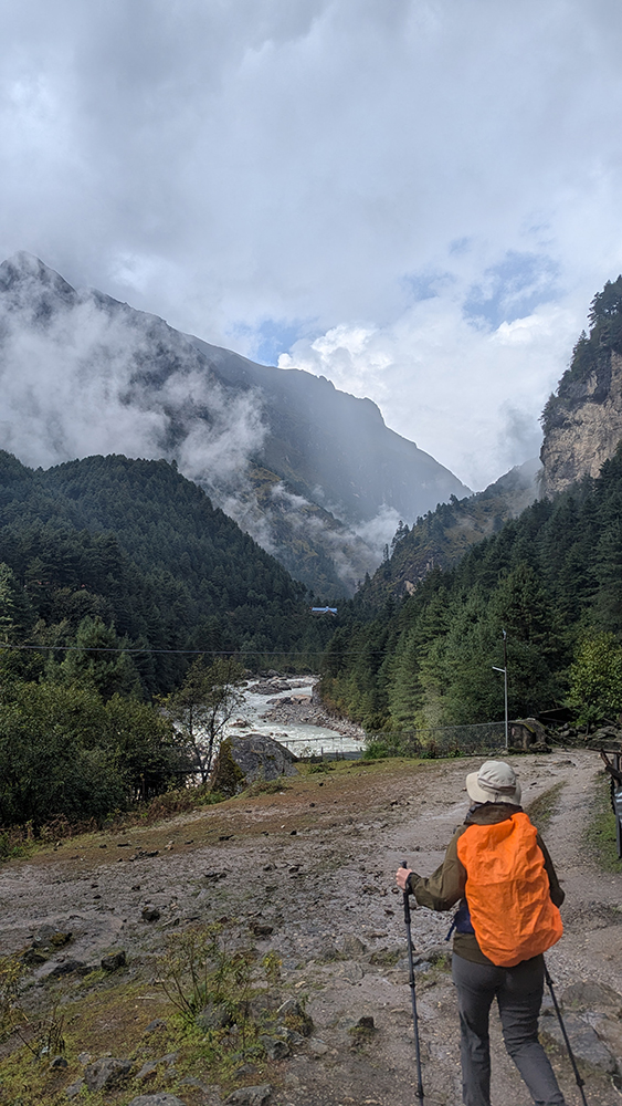
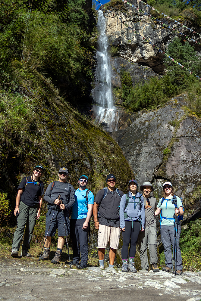
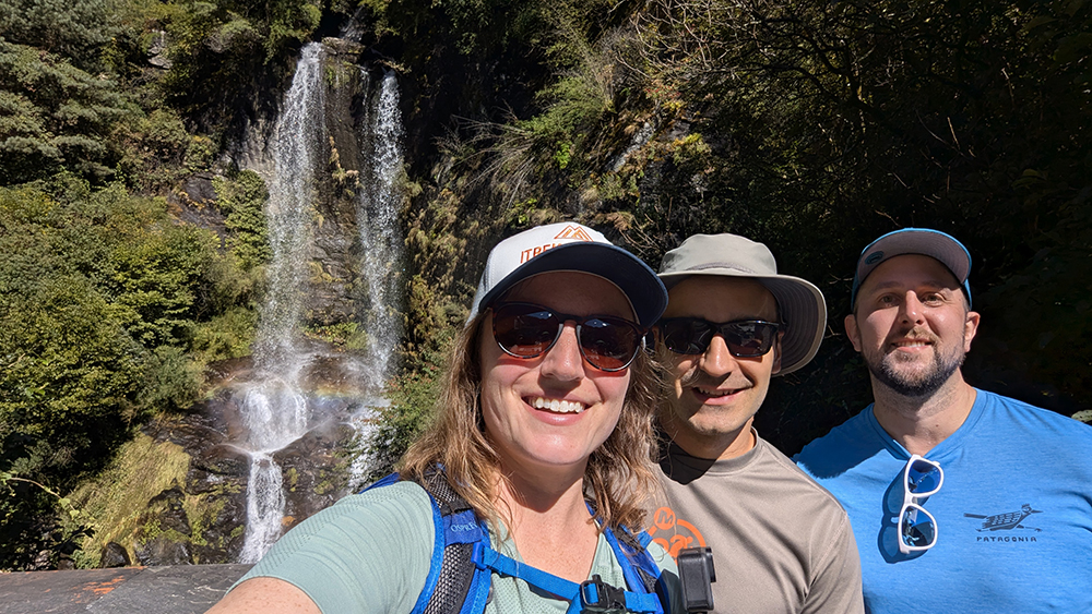
Unlike yesterday, the trail to Namche was uphill most of the way. In the morning, we passed under a couple of astoundingly tall waterfalls, as rainbows danced in their mist.

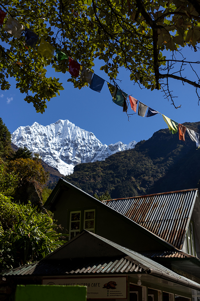
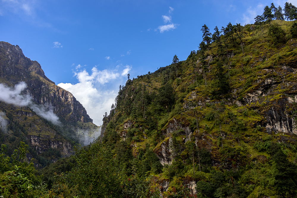
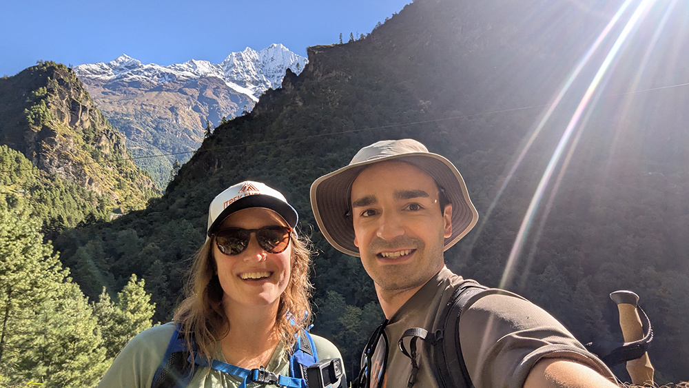
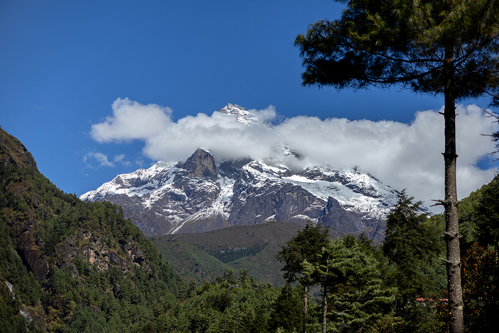
Because the skies were so clear, we were able to see more of the surrounding peaks, which would become grander and more immediate with every day of our ascent to Base Camp.
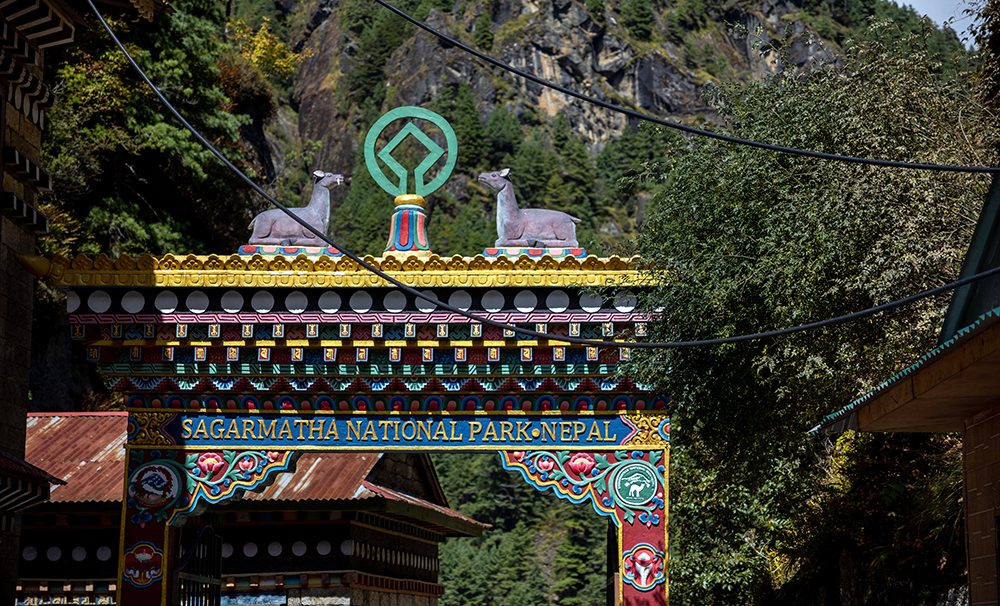
By midday, we found ourselves at the grand entrance gate to Sagarmatha National Park. Sagarmatha is the Nepali name for Mount Everest, while the Sherpa/Tibetan name for the mountain is Chomolungma, which means “Goddess Mother of the World.” Passing under the ornate gate, I felt a rush of exhilaration. It felt like we were one step closer to our goal, and now we were officially in territory that I had read about and imagined since I was a little girl.
There was a steep descending staircase just on the other side of the gate, and a huge cliff face alongside the stone steps had been carved into a giant mani stone. I craned my neck to look up at the carvings as we passed beneath it, moving deeper into the valley.
Now that we’d entered the national park, there were a handful of mammals that I was keeping an eye out for. Sagarmatha is home to elusive snow leopards, and red pandas, although it would take nothing short of a miracle to see either of those. Still, there were some other possible wildlife species we might actually have a prayer of seeing, so I wanted to be alert just in case.
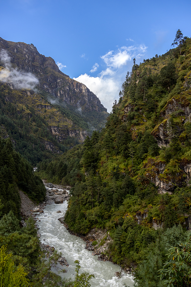
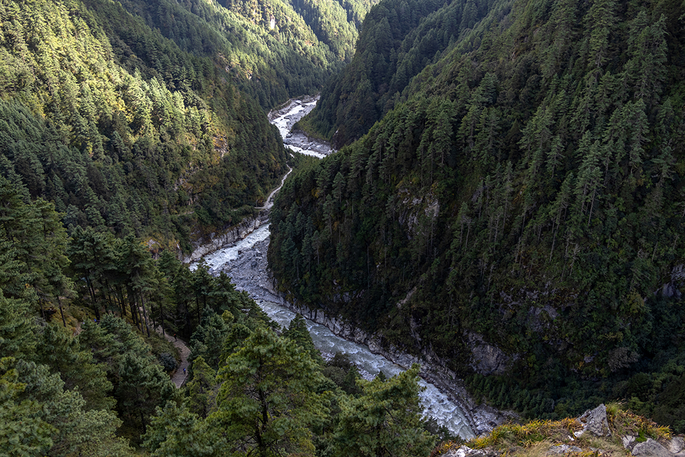
We had to cross a few more suspension bridges as we wound our way alongside the Dhudh Kosi River. A section of the trail had been washed out during the storms that blew through a few days earlier, which forced us to reroute for a bit and take a much steeper trail than the main one. But I didn’t embark on this adventure under any illusions that I wouldn’t have to climb hills, so I trodded along with the group as we inched our way higher through a dense forest. Sections of the trail were underwater, as temporary streams flowed over them. We had to hop across rocks to keep our feet dry, and when we finally reached the top of the hill, we were met with the sight of the famed Hillary Bridge.
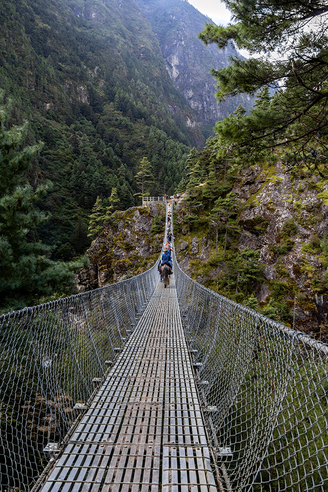
This wasn’t quite the same as all the other bridges we’d crossed that day. You could think of the Hillary Bridge as the father of all the other bridges. With a dizzying height of 443 feet (135 meters), it is one of the tallest suspension bridges in Nepal. Crossing over its 197 foot (60 meter) length was a dizzying prospect. We all stared at it in sober silence for a few moments before one of us dared to step out onto the thin slats of metal that were the only thing separating us from a 443 foot drop into the abyss.
I hung onto the bridge’s cables for balance as I tromped across its bouncing surface. PG pointed to another bridge far below us and said “bungee.” I looked over the edge and saw the bungee jumping station that Vince had hoped we’d get to stop at during our trek. I’d foolishly promised him and Thadd that I would bungee jump if they did, an activity that I have no interest in myself. Luckily for me, fate had worked in my favor (maybe it was all of the Prayer Wheels I’d been spinning for luck). Everest Bungee was closed during the duration of our trek, so I wouldn’t need to learn first-hand what bungee jumping feels like-at least not on this trip.
When we made it to the other side of the bridge, we stopped for a while and just stared at it some more. It truly was a dramatic sight, and the people who were starting to cross at the other side looked minuscule in comparison to the bridge’s size.

Beyond the Hillary Bridge, the trail ascended up a steep hill that would take us all the way to Namche. Tackling this hill would be the first hard part of the trek, but we still weren’t at too high of an elevation yet, so it was manageable with frequent breaks to rehydrate and catch our breath. We kept putting one foot in front of the other, hoisting ourselves up tall steps, until the trail leveled out a little bit and we found ourselves in a section of secluded forest.
I glanced down at the muddy path at just right moment, and happened to see a hoof print in the muck, “PG,” I asked, “Are there any deer that live in this forest?”
He told me that there are musk deer, but that he hardly ever sees them. A few feet further down the trail, he pointed into the underbrush and said, “There’s one!” clearly it was the same deer that had left the tiny hoof print I’d found.
The musk deer was diminutive, and when it looked up from its grazing, I saw that it had two long tusks protruding from its top jaw. A tusked deer was a first for me, and I enjoyed the moment without trying to switch out my lenses to get pictures. I had a feeling the deer wouldn’t stick around for long, and I didn’t want to miss getting a good look at it by fiddling with my camera gear. Sure enough, another group of trekkers caught up to us, and the deer got startled and bounded uphill until it was engulfed in the forest, ending our brief, but exciting encounter.
Shortly after this, we crested the top of the hill, and rounded a corner to find a sweeping view of Namche Bazaar, an energetic village built right on the mountainside. This first view was a magical moment for me. We’d worked so hard to get to Namche, and the sight of it was all the reward I needed for the effort.

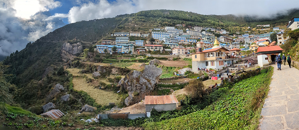
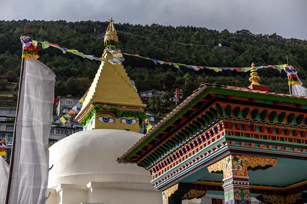
PG had a habit of booking us in the highest tea house available in each village, which meant that we would have the most amazing views when we woke up each morning. So we had to climb up through the whole town to reach our lodging, which was just find by me. We entered the village through a beautiful gateway, and got to see its impressive Stupa, which was huge for being built up in the mountains, and its set of hydro-powered prayer wheels that spun continuously.

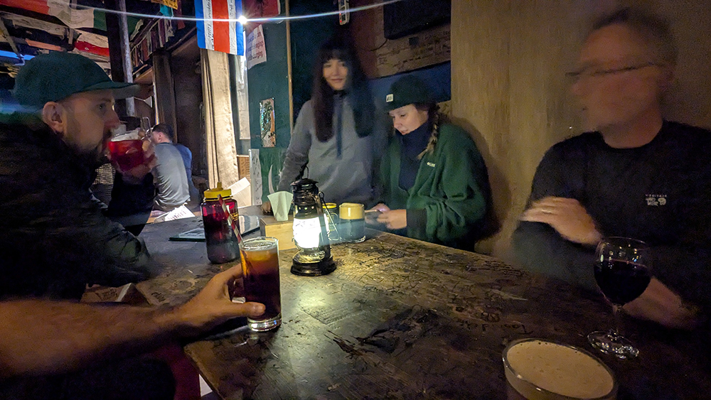
I felt elated as we ascended up to our teahouse. I was so happy to get to see such an iconic town, and the biggest trading hub in the Khumbu region. There’s no shortage of things to do in Namche either. From shopping for handmade souvenirs, to getting your haircut, to getting tattooed, to having a drink at the world’s highest Irish Pub, Namche has something to offer for everyone.
Upon arriving at our teahouse, we all exchanged a round of enthusiastic high fives for the day’s achievement. Then we had a quick cup of tea before returning to the streets to explore a bit before dinner. We spent the evening window shopping, and then popped into the pub for a celebratory toast before returning to the teahouse for dinner. After a hot shower (a commodity which would become scarce soon enough), I had a delicious Sherpa dish to end the evening.
So far it had been a successful couple of days of trekking, but we were still on the easy portion of the adventure to be sure. Things would only get tougher from here, but the scenery would also get even more beautiful to make up for it. I still didn’t know exactly what was in store for us over the coming days, but I knew one thing for certain: I couldn’t wait to find out!
You can see more details of this amazing destination on my YouTube channel!


Fabulous. Great memories in the making.